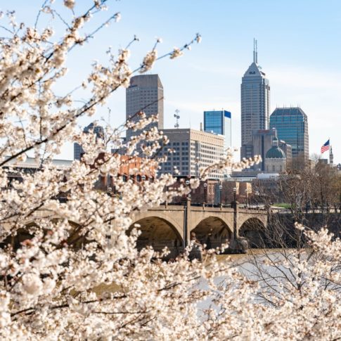
Central Indiana lies within the Wabash River Drainage Basin, with both Marion and Hamilton counties predominantly belonging to the White River Subbasin. Glaciers formed this topography about 20,000 years ago, with the waterways winding and changing shape for thousands of years while establishing White River as the central waterway to this area. Tributaries Stony Creek and Cicero Creek feed into White River in Hamilton County while Fall Creek and Eagle Creek feed into Marion County. The second northernmost anchor of White River within Marion County lies in the Village Lakes Reach, from 82nd Street south to 29th Street, at Broad Ripple.
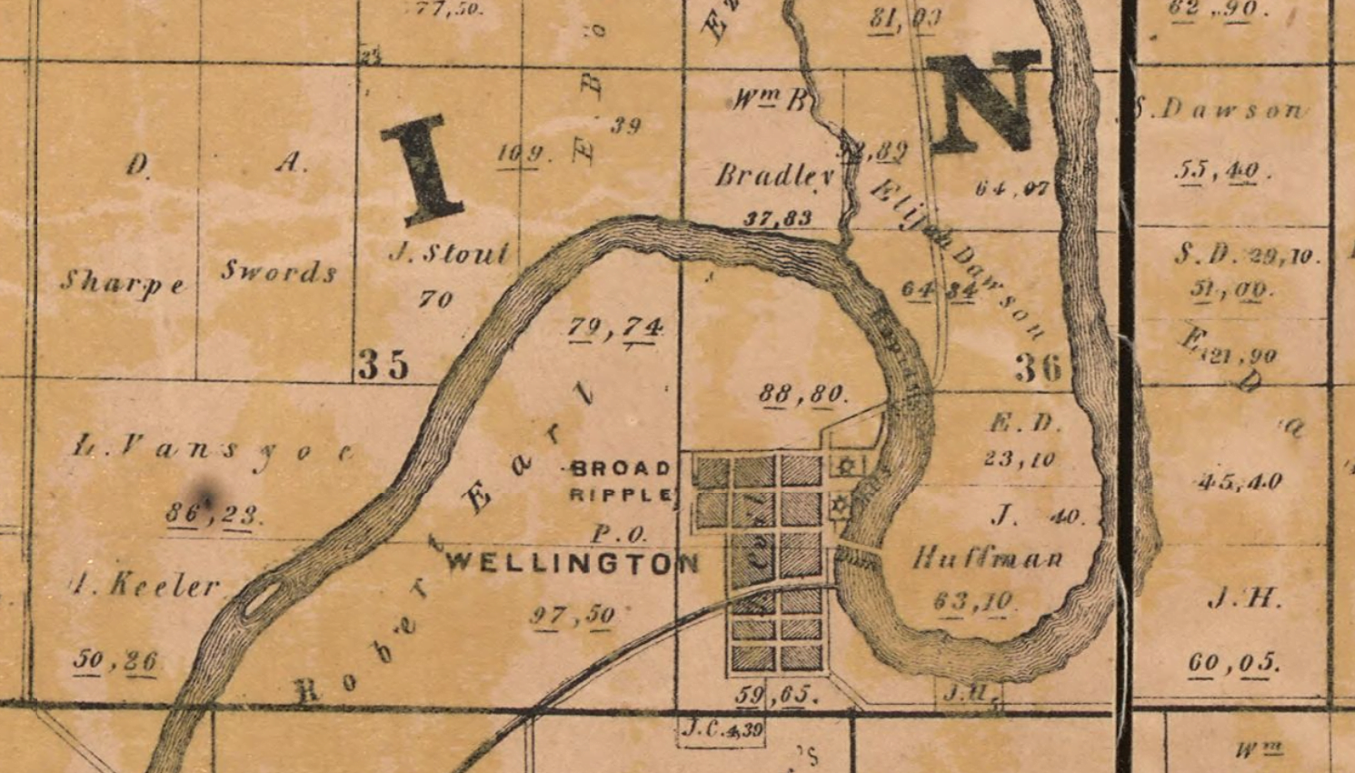
Early Native occupants of this land included many Great Lakes tribes: the Myaamia (Miami Nation), the Kaskaskia (Peoria Tribe), Kiikaapoi (Kickapoo), and later the Lenape (Delaware Tribe). The 1818 Treaty of St. Mary’s displaced Native Americans of their lands and almost all relocated west by 1820. During this time, a few white settlers were colonizing land in what would become Marion County, notably, John McCormick along the White River, and George Pogue on what would eventually be named Pogue’s Run. The state capital commissioners determined Indianapolis would be the new state capital in 1820, and the General Assembly approved the new location in 1821. In tandem, Marion County was founded in 1822, with nine townships totalling roughly 400 square miles. Also in 1822, John Calip and Jesse McKay purchased 147 acres of land along White River in the area; in 1836, Jacob Coil bought the land north of the Canal and the following year laid out 48 lots which he called ‘Broad Ripple.’ Four weeks later, James and Adam Nelson platted 32 lots on the southside of the canal, named ‘Wellington.’ A rivalry would ensue between the two villages until an 1884 gas explosion leveled much of Wellington and what survived incorporated with Broad Ripple.
The promise of waterway travel peaked in 1836 with the Indiana Mammoth Internal Improvement Act, which hoped to connect growing towns by a series of waterways, canals, and roads. One strip of canal was completed in Marion County from the area of Broad Ripple south to West Washington Street downtown, but ultimately this project was deemed a failure as it bankrupted the state and determined that White River was not navigable by large boats. Besides the Central Canal, the only other connection from Indianapolis to Broad Ripple was a 10-cent toll dirt road called “Range-Line” which would eventually become “Westfield Boulevard.” By the 1890s, streetcars provided consistent access to Broad Ripple from the city proper, leading to some of the farmland getting platted and summer or weekend “country homes” being constructed. The area was a popular pastoral getaway from the city, full of beautiful scenery along the oxbows of the White River in Ravenswood, Broad Ripple, Warfleigh, Crow’s Nest, and Rocky Ripple. Recreational activity included riverwalk strolls, miles of beach, canoeing, boating, swimming, and by 1906, visiting the White City Amusement Park.
But the 1911 subdivision advertisement imploring one to “Come out and build your summer home” was not meant for everyone. Like much of the country, segregation increased in the early 20th century due to the Great Migration of African Americans from southern states as well as the growth in Ku Klux Klan popularity. These riverfront beaches along White River found themselves segregated in the 1910s-1930s, and unfortunately in Indianapolis, public access was not divided only by a color line but also by a pollution line: blacks found the only accessible public beaches to be downstream, closer to industrial pollution, whereas whites retained access to the riverfront in the Village Lakes Reach.
Tagged in: Broad Ripple, History, Storytelling