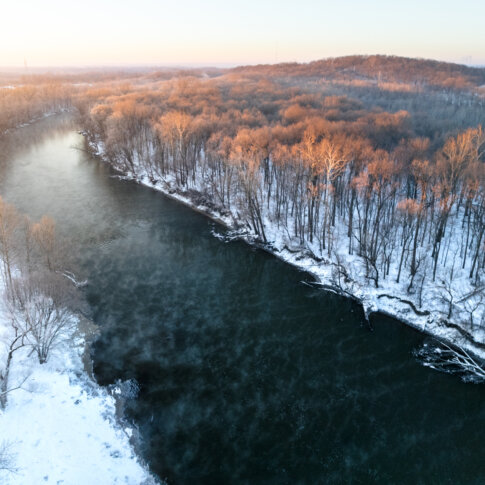
Central Indiana lies within the Wabash River Drainage Basin, with both Marion and Hamilton counties predominantly belonging to the White River Subbasin. Glaciers formed this topography about 20,000 years ago, with the waterways winding and changing shape for thousands of years while establishing White River as the central waterway to this area. Tributaries Stony Creek and Cicero Creek feed into White River in Hamilton County while Fall Creek and Eagle Creek feed into Marion County. The second southernmost anchor of White River within Marion County lies in the Protected Reach, from 29th Street south to I-465, at Emrichsville Dam.
Early Native occupants of this land included many Great Lakes tribes: the Myaamia (Miami Nation), the Kaskaskia (Peoria Tribe), Kiikaapoi (Kickapoo), and later the Lenape (Delaware Tribe). The 1818 Treaty of St. Mary’s displaced Native Americans of their lands and almost all relocated west by 1820. During this time, a few white settlers were colonizing land in what would become Marion County, notably, John McCormick along the White River, and George Pogue on what would eventually be named Pogue’s Run. The state capital commissioners determined Indianapolis would be the new state capital in 1820, and the General Assembly approved the new location in 1821.
The largest feature of the Protected Reach is Riverside Park. The area surrounding Riverside Park had large farming plats in the 1850s, although subdivision development would sprinkle in along the southern area near the National Road, aka Washington Street, by the 1860s. In the early 1900s, the areas surrounding the park were completely built up with housing. The park itself had previously been farming and dumping grounds prior to being purchased. Mayor Thomas Taggart, a parks and greenspace supporter, directed the park to be developed as part of a parks system based on the John Olmstead plan, expanded by George Kessler’s Park & Boulevard system a decade later. Paths, benches, landscaping, and water features were all added and additional enhancements included the Canoe Club, a private country club in 1900; nearby Riverside Amusement Park in 1903; the Shelter House, a Spanish Revival structure with a large open space, a refreshment stand and seating, and a locker room for golfers in 1904; a fish hatchery in 1911; additional parkland for golfing, athletics, etc. in 1926; a limestone colonnade monument dedicated to Mayor Taggart in 1931; a marina in the 1960s; and the nearby Major Taylor Velodrome in 1982. Riverside Park could be reached via automobile from either 30th Street or Indiana Avenue and by numerous streetcar and bus lines.
On the south end of Riverside Park was the Emrichsville bridge, dam, and Belmont Beach. The Emrichsville Dam was built to make the river deeper in the Riverside area, one of four dams in Marion County. It collapsed in 2018. The former Emrichsville Bridge was an impressive landmark in it’s own right: a beautiful arched stone bridge with asymmetrical towers. The bridge was demolished in 1949, and a new bridge was rerouted to better align with 16th Street after too many traffic issues. Belmont Beach, south of the bridge but near the dam, opened in 1936 and ran about 500 feet of a sand beach on the southwestern bank of the river. The beach had adult and child areas and two dressing tents. By 1943, pollution closed the beach due to the amount of raw sewage being pumped into the river.
Like much of Indianapolis, this area became highly segregated in the early 20th century due to the Great Migration of African Americans from southern states, and segregation intensified in the 1920s due to the increasing popularity of the Ku Klux Klan. By 1937, the entire area encompassing the park had been redlined – the discriminatory practice by which banks and mortgage lenders refused or limited loans and mortgages within specific geographic areas, particularly in older and inner-city neighborhoods, to non-white and/or low-income families by the guidance of the Federal Housing Administration – either “Definitely Declining” or “Hazardous,” leading to a decrease in investment. Public access was not divided only by a color line but also by a pollution line: blacks found the only accessible public beaches to be downstream, closer to industrial pollution, whereas whites retained access to the riverfront upstream. Suburbanization and white flight caused many white families to move from the area as urban renewal and highway construction displaced many black families, they moved into these northwest neighborhoods in the 1960s. In 1963, Riverside Amusement Park was finally desegregated, although it closed in 1970 and the area was redeveloped as a subdivision in the early 2000s.
The Riverside Park area compasses a great amount of riverfront in the Protected Reach, with the Marian-Cold Springs, Near Westside, Downtown, and Near Southside neighborhoods adjacent. White River State Park is nearby downstream.
Tagged in: History, Storytelling, RIverside, Emrichsville, Haughville, Belmont Beach