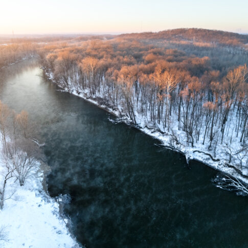
Central Indiana lies within the Wabash River Drainage Basin, with both Marion and Hamilton counties predominantly belonging to the White River Subbasin. Glaciers formed this topography about 20,000 years ago, with the waterways winding and changing shape for thousands of years while establishing White River as the central waterway to this area. Tributaries Stony Creek and Cicero Creek feed into White River in Hamilton County while Fall Creek and Eagle Creek feed into Marion County. The southernmost anchor of White River within Marion County lies in the South Bluffs Reach, from I-465 south to the edge of the county, at Southwestway Park.
Early Native occupants of this land included many Great Lakes tribes: the Myaamia (Miami Nation), the Kaskaskia (Peoria Tribe), Kiikaapoi (Kickapoo), and later the Lenape (Delaware Tribe). The 1818 Treaty of St. Mary’s displaced Native Americans of their lands and almost all relocated west by 1820. During this time, a few white settlers were colonizing land in what would become Marion County, notably, John McCormick along the White River, and George Pogue on what would eventually be named Pogue’s Run. The state capital commissioners determined Indianapolis would be the new state capital in 1820, and the General Assembly approved the new location at the confluence of the White River and Fall Creek in 1821, making it the new state capital in 1825. This area in southwest Marion County, in Decatur Township, was predominantly farmland. The 1855 plat maps show larger farming plats owned by R. Furnace, Elijah Wilson, Henry Peters, Tradell Sawyer; the eastern side of the river was owned by the Indianapolis & Bellefontaine Railroad Co. By the 1889 plat, many larger farming plats were owned by other Wilsons and Sawyers, along with the Dewees and Munns. Even throughout the 20th century, this area remained underdeveloped, with some small developments including Spring Valley, West Newton, and Valley Mills to the west and Mars Hill and Sunshine Gardens to the north. The park area, then known as Mann Hill, was of interest to the city’s parks department during an initiative in the 1950s and 1960s to create large regional parks in each quadrant of the county (hence a corresponding Southeastway Park on the eastern edge of the county). These regional parks were intended to supplement the smaller parks in the urban core and were meant to serve large geographic areas.
Although underdeveloped, the Mann Hill area was not underutilized prior to becoming a park. Mann Hill boasts the third highest elevation of Marion County, at 828 feet above sea level – Crown Hill Cemetery and a handful of Eagle Creek sites are higher – due to it being a glacial kame, or a large hill of outwash deposited from the edge of a melting glacier. This kame is a unique feature of the Wisconsin Glacial Age, our last glacial period from roughly 70,000 years ago. This height made it attractive in the early 1900s as a place for rifle practice and motorcycle play, and later, off-roading. Southwestway Park was established in 1961 with a golf course added a few years later. Additional acreage was acquired piecemeal over the decades and now includes just under 500 acres featuring 5 miles of trails for hiking, biking, and horseback riding, baseball fields, a golf course, and a playground.
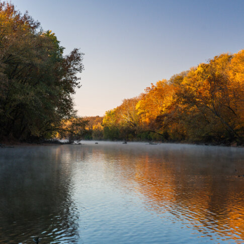
The White River leaves downtown Indianapolis and makes its way through Indianapolis Power & Light’s (now AES) power station, landfills, and wastewater treatment centers before reaching Southwestway Park. South of the park, White River continues to meander southwest out of Marion County briefly into Johnson County then through Morgan County on its way to connect with the larger Wabash River at Mt. Carmel, Illinois, eventually out to the Mississippi River, and finally ending in the Gulf of Mexico.
Tagged in: History, Storytelling, Southwestway Park